|
|
|
Unstable weather conditions expected late Monday through Tuesday
|
|
|
|
|
|
|
|
|
|
|
Basseterre, St. Kitts - St. Kitts Meteorological Services at RLB International has advised that the remnants of Gaston will cause unstable weather conditions across the area late today, Monday, 6th September, through Tuesday afternoon. The system still has a high probability (70%) of re-developing into a tropical cyclone, before it reaches the islands. A flash flood warning may be required later today, as up to 2 inches of rainfall is likely during the passage of the remnants of Gaston.
In view of this information, the National Emergency Management Agency (NEMA) appeals once again, to all individuals, families, organisations and institutions to be alert and prepared, in order to protect and or to minimise the impact of the aforementioned hazard, on life and property. Residents are strongly urged, among other preparedness actions, to refrain from parking vehicles or congregating close to or within ghauts or known waterways, as the potential for flooding is extremely high.
Conditions in the Federation today, will be mostly sunny with a 30% chance of scattered showers. Tonight, residents can expect cloudy to overcast conditions with periods of heavy showers and thunderstorms. Chance of showers and thunderstorms is 80%.
At 8:00 am, the centre of the remnants of Gaston, was located about 299 miles East of St. Kitts-Nevis. It is moving West at near 12 miles per hour and is expected to be near or over the islands late tonight and tomorrow morning.
Winds associated with the system are currently less that 30 miles per hour, however, residents are cautioned that damage and or loss of life does not only occur as a result of a system that is characterised by high or hurricane-force winds. Persons are encouraged to monitor the local media for further advisories and to do everything possible to themselves and their families.
Mariners should avoid open waters tonight up to and until the remnants of Gaston have passed. Seas are forecast to become locally rough by Tuesday morning with peak waves near 7 feet.
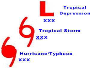
PLEASE NOTE THAT THIS SYSTEM IS CURRENTLY NOT A TROPICAL DEPRESSION, NOT A TROPICAL STORM AND NOT A HURRICANE. However, Gaston can re-develop, as noted before, into a Tropical Cyclone, prior to reaching the Federation of St. Kitts and Nevis.
|
|
|
|
|
|
|
|
