By La'Toya Webster
Writer-SKNVibes.com
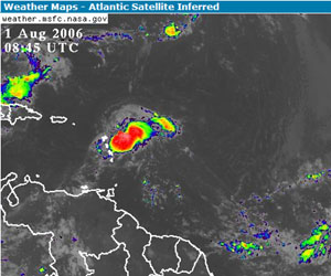
(Basseterre, St. Kitts) Tropical Storm Cris formed over night at about 8.00 p.m. last night, and was located 135 miles east of Antigua. That is approximately 200 miles east of St.Kitts and Nevis.
The center was located at 16.8 degrees north and 59.8 degrees west. It was moving west northly direction at 9 mph.
The maximum certain wind 40 mph with tropical storm force winds extended up to 35 miles from center.
Based on the forecasters out of Antigua they indicated that the storm should move to the north of St. Kitts, directly to Barbuda.
The Federation is expected to experience wind, rain and flash floods that may occur, with the weather changing in the evening.
"Small craft owners should take heed and bring their boats in, closer to shore, and persons with vehicles should avoid parking their vehicles in guts," said Carl Herbert, coordinator of the National Emergency Management Agency.
He told SKNVibes that the general public needs to listen to the media for more updates on the tropical storm.
"For this Hurricane season we're expecting 17 storms," he said.
Cris is the third named storm of the 2006 Atlantic hurricane season that developed near the Leeward Islands.
According to the National Hurricane Center a tropical storm warning was posted for the Islands of Antigua, Barbuda, Anguilla, St. Kitts, Nevis, Saba, St. Eustatius, St. Barthelemy and St. Martin.
A tropical storm watch was issued for Puerto Rico, the U.S. Virgin Islands and the British Virgin Islands.
~~Adz:Right~~The storm was on track to pass over or near the northernmost Leeward Islands by early Wednesday, according to the hurricane center.
The area where warning was issued was in the open Atlantic about 1,100 miles southeast of Miami.
The first named Tropical storm for 2006, Alberto, swept over Florida in mid-June. Massachusetts was spared the worst of tropical storm Beryl at the end of June when the storm left high surfs but minimal damage before heading towards Nova Scotia, Canada.