CHARLESTOWN, Nevis – THE Nevis Bio-diversity Group is all set to host a two-day training session on the Global Positioning System (GPS) this Saturday and Sunday (Mar. 28-29).
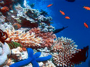
Executive Director of the Nevis Historical Conservation Society (NHCS) John Guilbert told SKNVibes that the training would allow participants to enhance their abilities to collect data related to the bio-diversity of the island. Biodiversity is the variety of life, the different plants and micro-organisms, their genes and the ecosystem of which they are part.
“The NHCS desires to collect data,” Guilbert said. “The data will document all flora and fauna of the island for posterity. This training will enable us to accomplish this goal and will allow us to train future students and volunteers as required.”
According to Guilbert, the training is probably the first of its kind in the region. He said the GPS training relates to the use of hand-held electronic devices. He explained that the GPS is a global navigation satellite system (GNSS) developed by the United States Department of Defense and managed by the United States Air Force 50th Space Wing.
It is the only fully functional GNSS in the world, can be used freely, and is often used by civilians for navigation purposes. It uses a constellation of between 24 and 32 Medium Earth Orbit satellites that transmit precise microwave signals, which allow GPS receivers to determine their current location, the time, and their velocity. Its official name is NAVSTAR GPS.
Since it became fully operational in 1993, GPS has become a widely used aid to navigation worldwide, and a useful tool for map-making, land surveying, commerce, scientific uses, and hobbies such as geo-caching. Also, the precise time reference is used in many applications including the scientific study of earthquakes. GPS is also a required key synchronisation resource of cellular networks, such as the Qualcomm CDMA air interface used by many wireless carriers in a multitude of countries.
Guilbert said training related to GIS would also be offered. He defined GIS as the computer mapping process of what is collected in the GPS fieldwork exercise.
GIS is a system of hardware and software materials used for storage, retrieval, mapping, and analysis of geographic data. Practitioners also regard the total GIS as including the operating personnel and the data that go into the system.
GIS can be used for scientific investigations, resource management, and development planning.
Guilbert said interested persons are welcomed to witness this one-of-a-kind training with students, facilitators and consultant Erin Haney from the USA.
The Saturday training will be in the morning at Fort Charles, where participants will learn how to use the GPS units to take readings. Arthur Vince Hubbard is expected to be on site, to provide a brief narration on the Fort and the role it played in Nevis history.
Sunday's session will be in the afternoon and this will consist of classroom training to learn how to input the GPS data into the GIS software and start making simple maps.
This training will take place up at the Nelson Museum where the new GIS lab is under construction.
Students participating in the course include Jeson LeBlanc, Tevon Glasgow, Romel Gaskin, Roann Eusebe, Shaquille Lewis and Rachel Yearwood. Adults include John Guilbert, Paul Diamond, Jim Johnson, Jenny Lowery, Barbara Whitman and Linden Williams.