BASSETERRE, St. Kitts - WITH Tropical Storm Fred still churning out in the Caribbean Sea, forecasters are closely monitoring another development that is expected to impact the Leeward Islands by this weekend.
Meteorologists have given formation for the next 48 hours a medium 60 percent and throughout five days there would be a high 70 percent chance of further development.
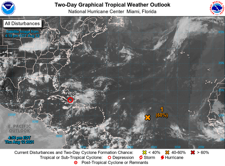
Satellite-derived wind data showed a small area of low pressure has developed along a tropical wave about 1200 miles east of the Lesser Antilles. However, the low does not quite have a closed circulation, and the associated shower and thunderstorm activity remains disorganised.
The National Hurricane Center said environmental conditions are expected to become more conducive for additional development, and a tropical depression is likely to form by this weekend while moving generally westward at about 20 mph across the tropical Atlantic.
The system is expected to reach portions of the Leeward Islands late tomorrow (Aug. 14) or early Sunday.
Invest 95L is expected to bring with it heavy rainfall and local met officials are urging all to monitor the development.
“Residents should monitor Tropical Disturbance AL95 closely and have their hurricane season plans prepared to safeguard life, property and livelihood, in the event watches and warnings are issued sometime in the next 48 hours” the statement read.
The St. Kitts Met Office said that a Tropical Cyclone alert is in effect for the Leeward Islands and the British Virgin Islands.
There is still a level of uncertainty regarding the formation and eventual track, size and intensity is not yet possible to say with high confidence of what will become of the system.