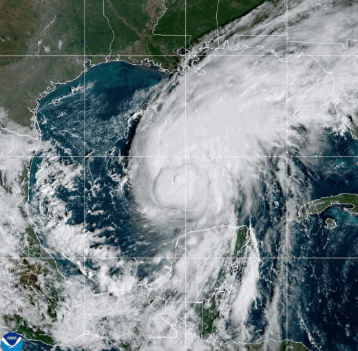
WASHINGTON, DC – WITH more than a month remaining in the 2026 Atlantic hurricane season, the first hurricane of the season has formed in the Atlantic and is expected to make landfall along the northern Gulf Coast of the United States.
Hurricane Isaias was packing maximum sustained winds of about 85 mph (140 km/h) on Thursday, with additional strengthening expected as it moves toward the U.S. coast.
At 1:00 p.m. CDT, the center of Isaias was located near latitude 24.0 North and longitude 89.8 West. The hurricane was moving east-northeast at about 10 mph (17 km/h), with a turn toward the northeast expected later today, followed by a turn toward the north on Friday.
According to the latest forecast, Isaias is expected to pass north of Mexico's Yucatan Peninsula before reaching the northern Gulf Coast, where landfall is projected for late Friday or early Saturday.
Forecasters warn that the system could remain a dangerous hurricane as it approaches the coast, with hurricane-force winds extending outward up to 15 miles (30 km) from the center, while tropical-storm-force winds extend outward up to 90 miles (150 km).
Several areas along the northern Gulf Coast have already been placed under hurricane and tropical storm watches and warnings as authorities prepare for the storm's arrival.
The system is expected to make landfall in Alabama, with forecasters also warning of the potential for heavy rainfall, flooding and tornadoes associated with the storm.
Residents in areas under watches and warnings are being urged to closely monitor updates from local authorities and emergency management officials as Isaias approaches.