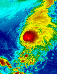
BASSETERRE, St. Kitts – THE season begins on Tuesday, June 1 and the National Oceanic and Atmospheric Administration (NOAA) has predicted that the world would witness an “active” to “extremely active” hurricane season across the entire Atlantic Basin.
The agency’s forecast, released yesterday (May 27), noted that anywhere from 14 to 23 named storms with top winds of 39 miles per hour or higher are predicted to form in the Atlantic Ocean, the Caribbean Sea and the Gulf of Mexico.
Eight to 14 of these storms have the potential to become hurricanes, with top winds of 74 miles per hour or higher, and three to seven of them may become major hurricanes, with winds of at least 111 miles per hours.
Under Secretary of Commerce for Oceans and Atmosphere and NOAA Administrator, Jane Lubchenco, said, “If this outlook holds true, this season could be one of the more active on record.”
She added that “the greater likelihood of storms brings an increased risk of a landfall. In short, we urge everyone to be prepared”.
Since the federal agency started issuing seasonal hurricane forecasts in 1998, this year’s prediction has been the highest.
According to Gerry Bell, lead seasonal hurricane forecaster at NOAA’s Climate Prediction Center, the main uncertainty in this outlook is how much above normal the season would be. “Whether or not we approach the high end of the predicted ranges depends partly on whether or not La Niña develops this summer”.
“At present,” he explained, “we are in a neutral state, but conditions are becoming increasingly favorable for La Niña to develop.”
Tropical storms are given names when wind speeds reach 39 miles per hour; they are upgraded to hurricane status when their sustained winds reach 74 miles per hour.
Historically, an average Atlantic hurricane season sees approximately 11 named storms, including six hurricanes, two of which become major hurricanes. And a major hurricane is classified as Category Three, Four or Five with winds of at least 111 miles per hour.

.jpg)