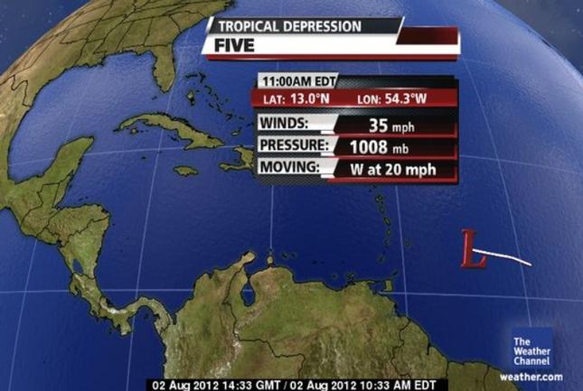
Tropical Depression Five formed in the Atlantic Ocean late Wednesday afternoon. Tropical storm watches have been issued for portions of the Leeward and Windward Islands.
Most of our forecast guidance shows the depression becoming Tropical Storm Ernesto while moving westward in the direction of the Windward and Leeward Islands.
It should arrive at these islands with rain and gusty winds by Friday, possibly as a tropical storm. The strength of the system at that point would ultimately dictate exactly how much wind to expect.
From there, the forecast calls for the system to move into the eastern and central Caribbean this weekend. However, much uncertainty remains in the exact long-term future of the system, partially due to the strength of winds in the upper atmosphere that the system may encounter. Strong upper-level winds are not favorable for the development of tropical cyclones and typically displace shower and thunderstorm activity away from the main center of circulation.
The official forecast calls for the system to eventually push toward hurricane intensity in about five days.
*************************
DISCLAIMER
This article was posted in its entirety as received by SKNVibes.com. This media house does not correct any spelling or grammatical error within press releases and commentaries. The views expressed therein are not necessarily those of SKNVibes.com, its sponsors or advertisers